The economic and logistical impact of hosting a major international summit is often felt most acutely in the urban infrastructure surrounding the event venues. In this case, the focus is on the corridor connecting the Philippine International Convention Center (PICC) and the Cultural Center of the Philippines (CCP). These two sites serve as the primary hubs for the summit, and the traffic measures are designed to secure the perimeter and ensure the timely movement of official convoys. The closure schedule is divided into two distinct phases, reflecting the anticipated increase in activity as the summit progresses.
The first phase, designated as partial road closures, begins on October 24 and runs through November 9. During this initial fortnight, traffic will not be entirely halted on all affected routes, but restrictions will be implemented to manage flow and facilitate security preparations. The affected arteries include portions of Vicente Sotto Street, Atang Dela Rama Street, Magdalena Jalandoni Street, Pedro Bukaneg Street, Diokno Boulevard, and Buendia Avenue. These roads form the immediate access network to the PICC and CCP complexes. Commuters and local businesses operating along these corridors must adjust their schedules, as the partial restrictions are intended to minimize disruption while still allowing for the necessary setup and security checks.
From November 9 to November 20, the measures escalate to full closures on these designated roads. This second phase likely coincides with the peak of the summit activities, where the volume of official traffic is expected to be at its highest. During this period, the affected stretches of Vicente Sotto, Atang Dela Rama, Magdalena Jalandoni, Pedro Bukaneg, Diokno, and Buendia will be inaccessible to general public vehicle traffic. This total exclusion is standard practice for high-level diplomatic events, aiming to create a secure buffer zone around the venues and key transit points for delegates.
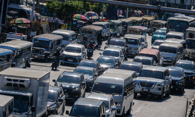
A notable aspect of the traffic plan is the conversion of public infrastructure for exclusive use. The designated bus lanes in the affected areas will temporarily be repurposed as “ASEAN lanes.” This shift prioritizes official vehicles and convoys carrying summit officials and delegates over regular public transport. For the local workforce and students who rely on bus lanes for faster commuting, this represents a significant change in service availability. The conversion underscores the hierarchy of movement during the summit, where diplomatic and security traffic takes precedence over civilian transit. Bus riders and motorists are advised to expect longer travel times and to plan alternative routes accordingly.
Beyond the specific closed streets, authorities have identified additional areas where traffic congestion is expected to spike. Portions of Macapagal Boulevard and Roxas Boulevard, as well as the areas near the World Trade Center, are flagged as high-congestion zones. While these specific roads may not face the same total closures as the PICC/CCP perimeter, the spillover effect of the summit-related traffic is anticipated to affect these major thoroughfares. Residents and businesses near the World Trade Center and along the Roxas Boulevard corridor should anticipate increased delays and potential detours.
The economic implications for local businesses in Pasay, particularly those situated along the affected streets, are constrained by the nature of the closures. While specific financial data on revenue impact is not provided in the available sources, the suspension of public events and the restriction of access to key commercial arteries can affect foot traffic and customer availability. The Pasay local government has also suspended public events in the city for the duration of the summit, further reducing the usual commercial activity associated with public gatherings. This suspension, combined with the physical road closures, creates a controlled environment that prioritizes security and diplomatic protocol over regular urban commerce.
The traffic management office has urged the public to allow extra travel time and to follow instructions from traffic enforcers and authorized personnel. The advice to take alternative routes is crucial for maintaining city-wide mobility, as the concentration of traffic on non-closed roads could lead to secondary congestion. The effectiveness of these measures will depend on compliance from motorists and the ability of the traffic management office to coordinate with security forces to ensure smooth transitions between the partial and full closure phases.
As the summit approaches, the focus remains on the seamless execution of these logistical plans. The two-phase approach allows for a gradual tightening of security and traffic controls, starting with partial restrictions on October 24 and moving to full closures on November 9. This structured timeline provides a clear framework for residents, businesses, and visitors to plan their movements in the weeks leading up to and during the event. The success of the traffic management strategy will be a key factor in the overall smoothness of the 49th ASEAN Summit, balancing the need for a secure environment with the maintenance of basic urban functionality.
The next critical point of observation will be the transition from the partial to the full closure phase on November 9. This date marks the shift from a state of heightened caution to a state of restricted access, potentially affecting a larger number of daily commuters and local businesses. The response of the public to these changes, and the ability of the city to manage the resulting traffic flow on alternative routes, will determine the extent of the disruption to Pasay’s daily economic and social life during this period.