The path of Isaias began with intensifying winds that whipped palm trees along the beaches of the Florida Panhandle and Alabama on Friday, October 9. As the storm swirled just offshore, it charged toward the U.S. Gulf Coast, representing the first hurricane to hit the eastern United States since Hurricane Milton in 2024. Forecasters at the National Hurricane Center had warned of a significant threat, noting that the storm was on course to arrive as a major hurricane. Robbie Berg, a national warning coordinator for the center, indicated that late Friday tracking suggested landfall would likely occur over the western panhandle near the Pensacola area.
Despite the warnings, the storm’s intensity remained formidable. In the hours leading up to landfall, the system was centered about 90 miles south of Pensacola, moving north-northeast with maximum sustained winds of 115 mph. Category 3 storms, such as Isaias was classified before weakening, are considered major hurricanes capable of causing widespread devastation. A hurricane warning spanned from Ocean Springs, Mississippi, to the western Florida Panhandle. In response, several counties announced mandatory evacuations, and Mobile, Alabama, imposed a curfew from Friday evening until morning.
The human toll was quickly established. During an October 13 press conference, Florida Governor Ron DeSantis announced that the state’s storm-related death toll had risen to six. Alabama officials confirmed a second storm-related death, bringing the overall death total for Hurricane Isaias to at least eight. While specific details of the Alabama death were not immediately available, the figures underscore the lethal potential of the storm’s wind and water.
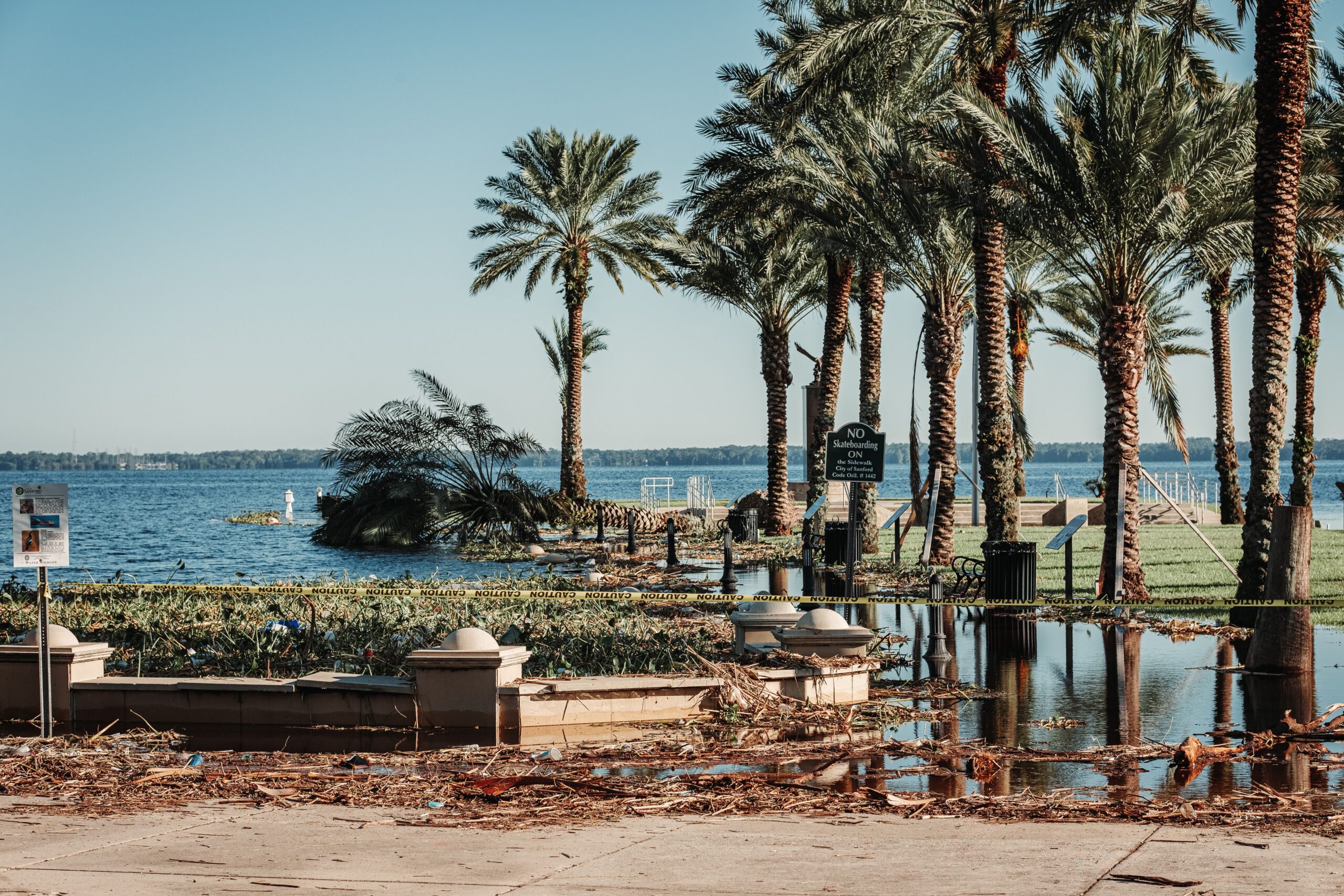
The physical impact on the landscape was equally measurable. According to the FOX Forecast Center, Panama City Beach recorded its second-highest storm surge on record. Water levels rose 5.60 feet above the average high tide, a figure that surpassed the surge generated by Hurricane Michael in 2018, which ranked fifth at 3.86 feet. The only higher surge on record for the area was set during Hurricane Opal on October 4, 1995. This data highlights the extreme nature of the storm’s interaction with the low-lying coastal geography, which is characterized by powdery white sand beaches dotted with vacation homes and waterfront businesses.
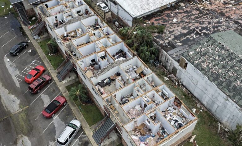
Wind damage was widespread. The FOX Forecast Center reported wind gusts exceeding 110 mph across parts of the Florida Panhandle. In the aftermath, workers from Southern Land Services were seen removing trees that had landed on homes in Milton. The storm also generated significant rainfall, with totals topping a foot in parts of Alabama and Florida. As Isaias moved inland, it delivered strong winds and rain well north into Atlanta, with 4 to 8 inches of rain expected from southern Alabama to southwestern Georgia through the weekend.
The storm’s passage left a significant wake in terms of infrastructure. Power outages continued across the Southeast as Isaias moved inland. At the storm’s peak, over one million Americans were in the dark. As of 10 p.m. Eastern Time on Saturday, more than 450,000 customers remained without power. The disruption extended to air travel, with most flights grounded at several Panhandle airports, including all flights into and out of Destin-Fort Walton Beach Airport.
The economic and social ripple effects were evident in local communities. In Gulf Breeze, Florida, residents like Anne Petzold and her husband had prepared by installing hurricane shutters and securing yard items that could become projectiles. Petzold described the community spirit, noting that neighbors asked for help and offered it in turn, framing the event as “just another adventure.” However, the severity of the threat was reflected in the closure of dozens of Waffle House locations in the Florida Panhandle. The restaurant chain is often used as an informal indicator of storm severity; Kelsei Frazier, a resident of Pace, Florida, noted that the closure of these establishments was “a pretty big deal,” signaling the magnitude of the emergency.
The context of Isaias is complicated by broader climate patterns. The storm emerged during an unusually quiet Atlantic season, a phenomenon linked to El Niño conditions. Reports indicated that El Niño was surging toward “monster” territory, signaling an active winter for the East and West Coasts but suppressing hurricane activity in the Atlantic. This makes Isaias an outlier in a season that had previously seen very little hurricane activity. The storm was expected to miss the oil industry’s biggest hubs along the Gulf Coast, but industry experts warned that fuel prices could rise if power outages shut down refineries.
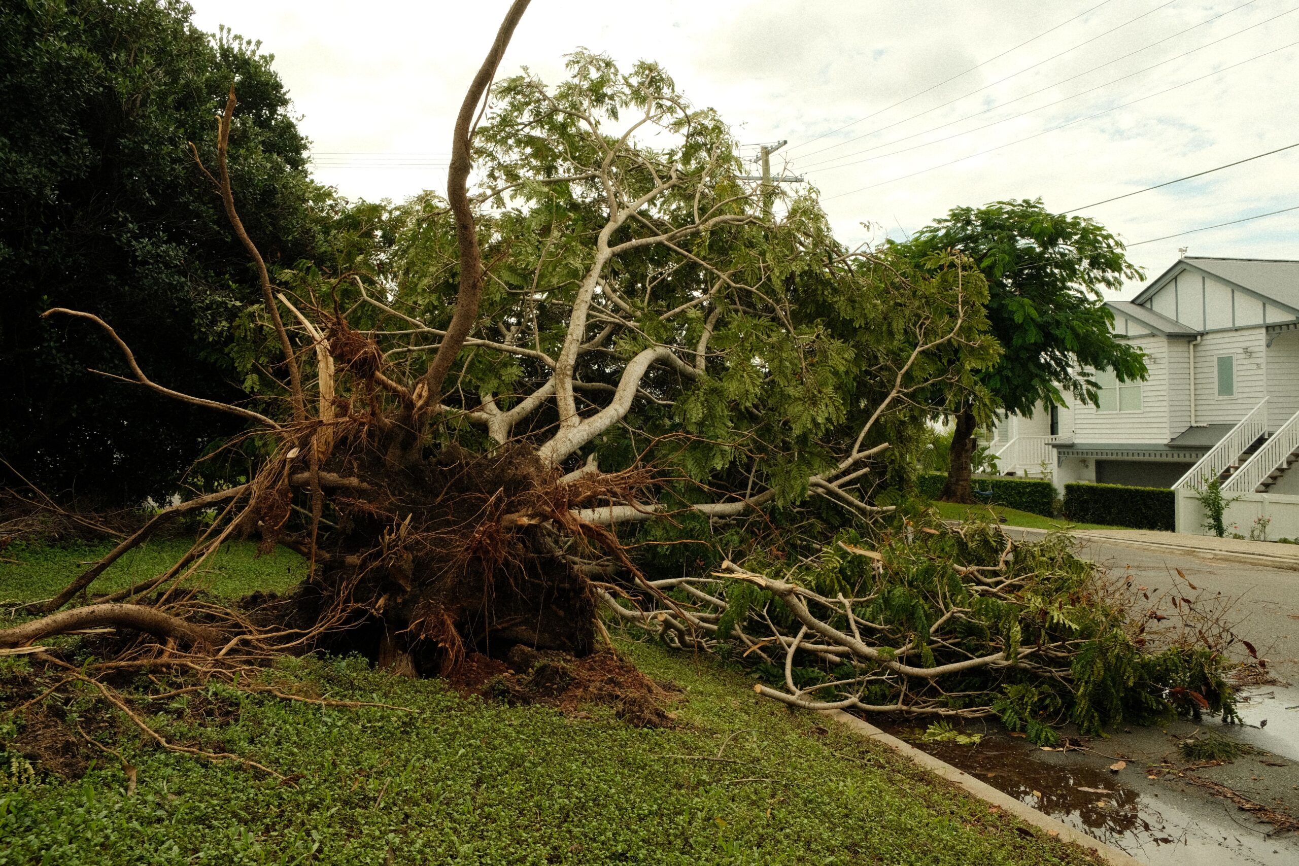
As the storm moved inland, it was forecast to weaken and downgrade to a tropical storm by Saturday afternoon. However, the threat did not end with landfall. The system continued to move north-northeast, bringing heavy rain and potential flooding to much of the Southeast. President Donald Trump, who had initially planned to attend a football game between the University of Georgia and the University of Alabama in Tuscaloosa, scrapped his plans to avoid disrupting the emergency response.
The uncertainty surrounding such storms remains a constant challenge. On Dauphin Island, a barrier island off the Alabama coast, Mayor Jeff Collier expressed the precarious nature of hurricane forecasting. “At the same time, these things are very fickle and a little jog here or there, or some last-minute increase in strength — we just have to be prepared for the worst,” Collier said. This sentiment reflects the ongoing tension between preparedness and the unpredictable nature of tropical cyclones.
In the weeks following the storm, the focus shifts to recovery and assessment. The six deaths in Florida and the two in Alabama are confirmed, but the full extent of the damage is still being evaluated. The storm surge data from Panama City Beach provides a critical benchmark for future coastal planning, while the widespread power outages highlight the vulnerability of the regional grid. As cleanup crews like those from Southern Land Services work to clear debris from homes in Milton, the community faces the long process of rebuilding. The episode of Hurricane Isaias serves as a reminder that even in a quiet Atlantic season, the potential for a major hurricane remains, driven by complex climate dynamics like El Niño and the inherent volatility of the Gulf Coast environment.