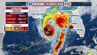
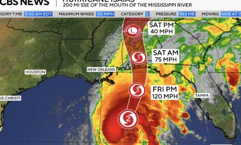
Forecasters have issued hurricane warnings for the coastline from Ocean Springs, Mississippi, to the Bay/Gulf County line in Florida. Tropical storm warnings extend from the Jefferson/Plaquemines Parish line in Louisiana to the Aucilla River in Florida. The NHC emphasized that preparations must be completed immediately, warning that conditions will deteriorate quickly. While the storm’s intensity may fluctuate slightly before landfall, it is forecast to remain at or near major hurricane strength upon impact.
The most immediate threat is life-threatening storm surge. A storm surge warning is in effect for the coast from the mouth of the Mississippi River to the Suwannee River in Florida, with a watch extending to Yankeetown. Official forecasts indicate surge heights could reach up to 9 feet from the Alabama-Florida border to Grayton Beach, Florida, with other parts of the Panhandle facing surges of up to 6 feet. These surges, combined with the tide, are expected to flood normally dry coastal areas. Hurricane-force winds are anticipated to extend up to 100 miles inland into southern Alabama.

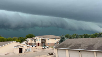
Significant rainfall is also expected, with 4 to 8 inches falling across southern Alabama, the Florida Panhandle, Florida’s Big Bend region, and southwest Georgia. Localized areas may receive up to 15 inches, creating a high risk of flash flooding, particularly in urban centers. An additional 2 to 5 inches of rain are forecast for much of the remaining Southeast, with up to 10 inches possible across the Southern Appalachians and coastal Carolinas. Forecasters have also warned of a risk of tornadoes spinning off the storm from Friday afternoon through Saturday, with the threat extending into parts of Georgia and the Carolinas.
Government officials have ordered evacuations in response to the approaching storm. Mandatory evacuations are in place for parts of Okaloosa and Walton counties in Florida’s Panhandle. In Alabama, Governor Kay Ivey has issued an order requiring all non-residents, tourists, and visitors in Baldwin County south of the Gulf Intracoastal Waterway—including Gulf Shores and Orange Beach—and on Dauphin Island in Mobile County to leave immediately. The storm is notable for being the latest-forming first hurricane ever recorded in the Atlantic basin, a development that ended a record-breakingly quiet season characterized by suppressed tropical development due to a growing El Niño pattern.

After making landfall, Isaias is expected to weaken rapidly into a tropical storm while tracking north through Alabama and brushing the eastern edge of Mississippi. Although the winds will diminish, the system will continue to drive heavy rains and dangerous winds into the interior of the Southeast through the weekend. Residents in affected areas are advised to monitor official updates and maintain their preparedness plans as the storm makes its final approach.