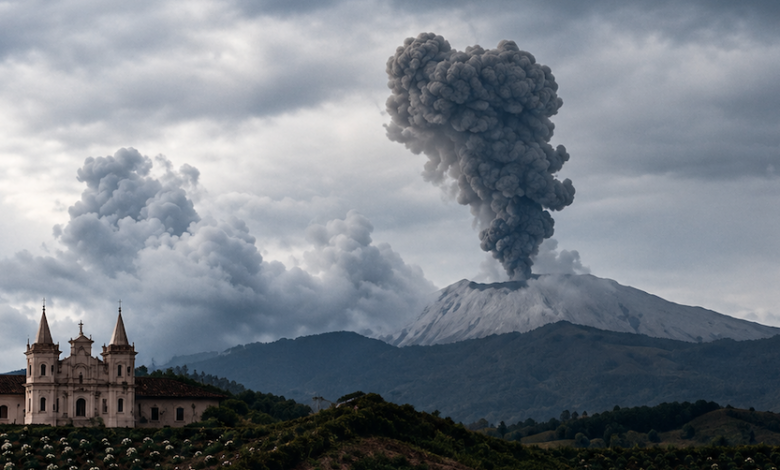
The current state of alert follows a period of intensified activity that began in late November 2025. On November 30, monitoring stations recorded a sharp increase in volcanic tremor and long-period seismicity, signals that scientists associate with the movement of fluids, such as magma or gas, inside the volcanic conduits. This activity prompted the SGC to raise the alert level for the entire Los Coconucos chain to orange on December 1. Since then, the volcano has exhibited continuous emissions of gases and pulses of volcanic ash, with plumes rising more than 700 meters (2,300 feet) above the summit, which stands at 4,650 meters (15,260 feet) above sea level. Occasional ashfall has been reported in nearby communities, though initial reports indicated no significant material damage or injuries directly attributable to the ashfall.
The SGC’s monitoring data reveals a complex pattern of activity. In addition to the deep-seated fluid movements, the volcano has experienced superficial earthquakes associated with rock fracturing. On August 30, a swarm of approximately 50 seismic events occurred, with magnitudes ranging from 2.8 to 4.1. These events were located 11 kilometers northeast of the Puracé crater at a depth of nine kilometers. Cristian Santacoloma, coordinator of the Popayán Volcanological and Seismological Observatory, noted that while such activity can occur within a volcanic influence zone, it has not fundamentally altered the established trend of fluid-dominated behavior. The agency continues to track other parameters, including elevated concentrations of sulfur dioxide (SO₂) and carbon dioxide (CO₂) in the soil, as well as higher temperatures in ash and gas emissions, which the SGC described as significant alterations from baseline levels recorded since systematic monitoring began in 1993.
Public concern was heightened in August 2025 when a magnitude 7.4 earthquake struck western Colombia, with its epicenter near San José del Palmar in Chocó department. This seismic event occurred on the same day that Puracé recorded five ash emissions, leading to initial speculation about a causal link. However, the SGC explicitly stated that its monitoring data showed no relationship between the two events. The volcano had already entered a period of increased activity prior to the earthquake, and the magnitude 7.4 tremor did not produce additional changes in Puracé’s behavior. Santacoloma confirmed that the earthquake did not affect the activity of Puracé or the other volcanoes in the chain, a distinction crucial for accurate public communication and risk management.
The geographic scope of the alert covers the Los Coconucos volcanic chain, which extends from southwestern Colombia into the departments of Huila, Tolima, and Caldas. Puracé itself is located in the Cauca department, approximately 27 to 30 kilometers from the departmental capital, Popayán, and about 200 kilometers from the Pacific coast. The volcano is one of 15 cones in the chain, whose last considerable eruption occurred in March 1977. Since 2021, the SGC has noted gradual changes in the volcano’s activity, leading to the current high-alert status.
Authorities have issued repeated warnings to residents and visitors to refrain from accessing the upper parts of the volcano, specifically the craters of Puracé, Piocollo, and Curiquinga. The proximity of the Puracé National Park, located just 30 kilometers east of Popayán, underscores the potential impact on both tourism and local ecosystems. While the orange alert does not signify that an eruption is underway, it serves as a critical indicator that the volcano is undergoing significant physical changes. The SGC continues to utilize a combination of seismic measurements, gas concentration analyses, ash emission tracking, and satellite observations to assess the situation in real-time.
As the monitoring continues, the focus remains on the persistence of the signals associated with fluid movement beneath the crater, where volcanic tremor has been detected at depths of less than one kilometer. The distinction between these deep fluid signals and the shallower rock fracturing events is vital for understanding the volcano’s internal mechanics. The SGC’s ongoing bulletin system, which includes aviation warnings for ash dispersal, highlights the operational response to the hazard. For now, the scientific consensus is that while the risk is elevated, the specific timing or scale of a potential eruption remains uncertain, necessitating continued vigilance from both the scientific community and the local population.