
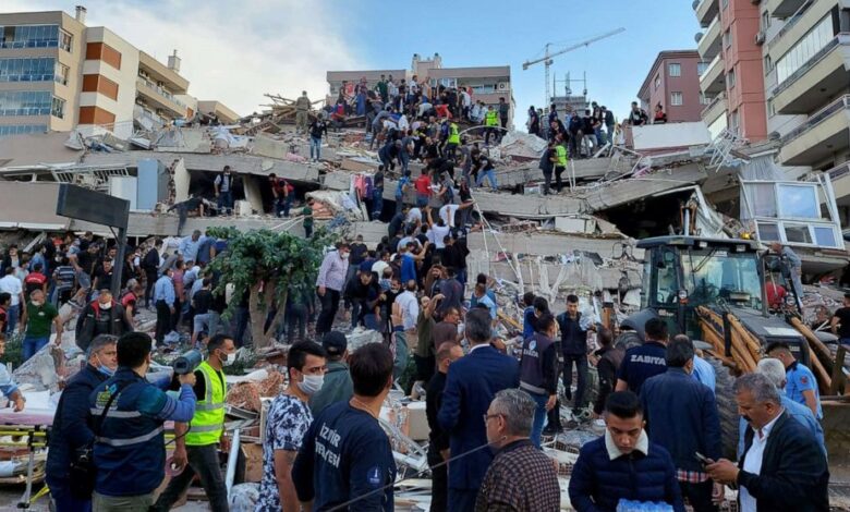
The disparity in impact between the smaller Greek town and the major Turkish city is the subject of a detailed forensic analysis by researchers Mustafa Erdik, Mine B. Demircioğlu, and Cüneyt Tüzün. Their investigation identifies three primary factors responsible for the severity of the destruction in Izmir: strong amplification of ground shaking, poor compliance with building codes, and inadequate construction inspections. These findings highlight a critical vulnerability in how seismic hazards are managed in densely populated coastal cities situated in geologically complex basins.
Izmir is located around the Inner Izmir Bay, a shallow marine basin that is actively growing and controlled by active east-west trending extensional, or “normal,” faults within the Aegean Extensional Province. The basin is filled with young Holocene alluvium and fan-delta to shallow marine deposits. According to the analysis, this specific geological composition played a crucial role in the earthquake’s impact. The soil and sediment in the basin amplified the seismic waves from the offshore event, intensifying the shaking experienced by the city. This amplification effect means that the ground motion in Izmir was significantly stronger than what might be expected based solely on the distance to the epicenter.
Compounding the natural hazard was the state of the built environment. The analysis points to buildings constructed in the 1990s, a period characterized by poor code compliance and inadequate construction inspections. Approximately 4% of the city’s buildings were affected by the earthquake, with six collapsing completely. The researchers note that had these structures been designed with better assessments of potential ground motion and constructed in full compliance with modern seismic codes, the loss of life and physical damage would likely have been significantly reduced.
The ability to conduct such a precise forensic analysis was made possible by two key re