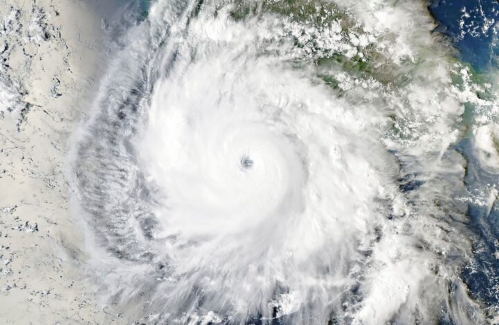
The storm’s trajectory has been characterized by extreme rapid intensification. Beginning as a tropical disturbance in mid-September 2026, Polo quickly organized into a tropical depression and then a tropical storm. By September 22, the storm’s maximum sustained wind speeds increased by 90 knots (167 km/h or 104 mph) within a single 24-hour period, a rate that meets the technical classification for extreme rapid intensification. NOAA’s Hurricane Hunter aircraft measured winds of nearly 285 km/h (180 mph) during a reconnaissance flight on that day, a strength that would place it among the strongest storms on record in the eastern Pacific basin by maximum sustained winds.
Scientists attribute this explosive growth to a “near perfect” atmospheric environment. Gary Partyka, an atmospheric scientist at NASA’s Goddard Space Flight Center, noted that conditions included weak wind shear, high moisture levels, and significant atmospheric instability. Sea surface temperatures in the region reached as high as 32°C (90°F), which is 2 to 3 degrees warmer than the average for late September. Kristen Corbosiero, an atmospheric scientist at the State University of New York at Albany, highlighted that the storm benefited from good outflow patterns and high ocean heat content at considerable depths, which helped sustain its intensity despite the storm churning up cooler water from below.
Following its peak intensity, Polo underwent an eyewall replacement cycle that temporarily weakened it to Category 3 strength, with winds of 125 mph (200 km/h) as of Sunday morning. However, the storm is forecast to maintain or regain significant strength as it moves over unusually warm waters of 28-29°C (82–84°F) with light to moderate wind shear. Forecasts indicate Polo will make landfall with sustained winds of 110 mph (177 km/h), potentially rivaling Norbert (2008) and Jimena (2009) as the strongest landfalling storms on record for Baja California.
The satellite imagery of Polo is very impressive, with the storm’s large, clear eye and extensive outflow pattern. Weak winds above the system and good outflow at the top of the system also contributed to Polo’s rapid intensification.
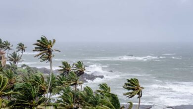
Photo by Pixabay / Pexels
Regardless of the exact intensity at impact, the storm poses severe threats to the region. Rainfall estimates range from 4 to 8 inches (10 to 20 cm) over central Baja California Sur, with localized pockets potentially reaching 12 inches (30 cm). Parts of southern Sonora state are also expected to receive 4 to 6 inches (10 to 15 cm) of rain. These totals carry a high risk of life-threatening flash floods and mudslides, particularly given the rugged terrain of the peninsula. Dangerous surf and rip currents are expected to persist through Monday, with swells spreading northward along the west-central Mexican coast.
After making landfall, Polo is expected to weaken rapidly as it crosses the mountainous terrain of Baja California. By Tuesday, the system will likely have transitioned into a tropical storm and eventually a remnant low. Despite its weakening, the storm is expected to have “staying power” as it is absorbed into a larger weather system over the U.S. Southwest. This transition will drive widespread moisture into New Mexico, Texas, Oklahoma, and Kansas. The National Weather Service has issued warnings for potentially excessive rainfall, with forecasts predicting 3 to 5 inches (7.5 to 12.5 cm) of rain over several days in parts of the region. In some areas of Arizona and New Mexico, rainfall amounts could reach historic levels, with a 1-in-10 to 1-in-25 chance of exceeding flash flood guidance. While the moisture is beneficial for drought-stricken areas, the potential for deadly flash flooding remains a primary concern for emergency managers.
Meanwhile, Tropical Depression 18E, which upgraded to Tropical Storm Rachel on Sunday, is forecast to remain well offshore, paralleling the coast toward Baja California. Cooler waters upwelled by Polo may help modulate Rachel’s strength. While the exact track of Polo’s remnants introduces uncertainty regarding the precise location of the heaviest rains in the U.S., the broad pattern of significant precipitation across the Southwest and Central Plains is expected to continue through the end of the month.
Nicole Martin writes about environmental issues, climate policy, sustainability, conservation, and major weather-related developments. She follows environmental research, government action, and changes affecting ecosystems and communities. Nicole focuses on presenting complicated environmental stories in accessible language while keeping scientific evidence and verified information at the centre of her reporting.