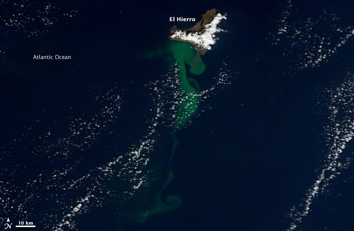
The eruption occurred in shallow water, ranging from tens to a few hundred meters deep. The plume is likely a mixture of volcanic gases and a blend of crushed pumice and seafloor rock. This injection of material into the ocean waters turned the sea green, a phenomenon visible from space and indicative of significant subsea activity. The event was not sudden but the culmination of a period of intense seismic unrest that began in July 2011.
For several months prior to the eruption, seismic stations on El Hierro, particularly in the northwest of the island, recorded thousands of tremors and earthquakes. The island, which is built mostly from a shield volcano, experienced this seismicity as magma moved through the crust. However, the dynamic shifted on October 12, 2011. On that date, the strength of the tremors significantly decreased. Simultaneously, foaming, rock-strewn plumes appeared in the sea to the south of the island. This transition suggested that the volcanic energy was moving from deep crustal movement to surface expression through the water column.
Geologist and blogger Erik Klemetti analyzed the satellite data, noting that the main fissure appeared to be 2 to 3 kilometers in length. He observed that the fissure was close to being on strike with the rift axis for the main El Hierro edifice, indicating that the eruption was occurring along a known structural weakness in the island’s volcanic architecture. The underwater plume of volcanic debris persisted for nearly two weeks after its initial appearance, where it was mixed and dispersed by ocean surface currents. This dispersion pattern helped define the extent of the impact, showing how marine dynamics interact with volcanic inputs.
While the current activity was confined to the underwater environment, officials and scientists monitored the situation for potential escalation. Ramon Ortiz, coordinator of a government scientific team, outlined the expected progression if the eruption reached shallower water. He stated that observers should expect the surface water to start steaming, followed by explosions of steam and magma, and finally the emergence of a new island. This potential evolution from a submarine eruption to a subaerial island formation represented a significant geological transformation for the region.
Local monitoring was critical during this period. The Instituto Geografico Nacional provided local seismic information for El Hierro, allowing authorities and scientists to track the real-time changes in seismic activity. The data confirmed the initial spike in tremors in July and the subsequent reduction in strength as the eruption began in mid-October. This correlation between seismic decay and surface eruption is a standard indicator in volcanic monitoring, helping to distinguish between different phases of volcanic activity.
The environmental impact of the eruption was primarily marine. The injection of gas and crushed rock altered the water column, creating the visible green plume. The depth of the eruption, ranging from tens to hundreds of meters, meant that the interaction between the hot magma and the ocean water was vigorous, likely generating the foam and rock-strewn plumes observed on October 12. The persistence of the plume for nearly two weeks demonstrated the scale of the material being ejected, which was substantial enough to be tracked by satellite over a distance of 100 kilometers.
The event highlighted the dynamic nature of the Canary Islands, where volcanic activity is a recurring, though infrequent, feature. The fact that this was the first eruption in the chain in nearly 40 years underscored the long periods of dormancy that can precede significant geological events. The monitoring efforts, combining local seismic stations with satellite imagery, provided a comprehensive picture of the event, from the initial tremors to the spread of the debris plume.
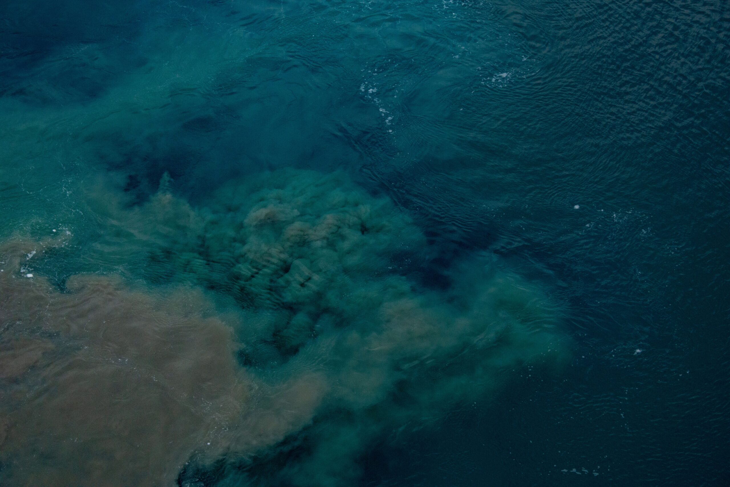
As the plume dispersed and the immediate surface activity was tracked, the focus remained on the potential for further development. The possibility of island emergence, as noted by Ramon Ortiz, kept the scientific community and local authorities on high alert. The interplay between the volcano’s internal pressure, the depth of the water, and the ocean currents determined the specific characteristics of the eruption. The green waters off El Hierro served as a stark reminder of the powerful geological forces at work beneath the surface, forces that can reshape coastlines and marine environments in a matter of weeks.
The case of El Hierro in 2011 remains a documented instance of submarine volcanic activity in the North Atlantic. The satellite records from NASA’s Terra satellite provide a permanent visual archive of the event, capturing the extent of the plume and the interaction between the eruption and the ocean. The data collected by seismic stations and the observations made by geological experts offer a detailed account of how such events unfold, from the initial tremors to the surface expression of magma and gas.
For the residents of El Hierro and the broader Canary Islands, the eruption was a significant disruption, requiring ongoing monitoring and adaptation to the changing environmental conditions. The green plume, while a striking visual phenomenon, represented a complex mixture of gases and rock that affected the local marine environment. The event stands as a testament to the ongoing geological processes that shape the Earth’s surface, even in regions far from the center of the island chain.