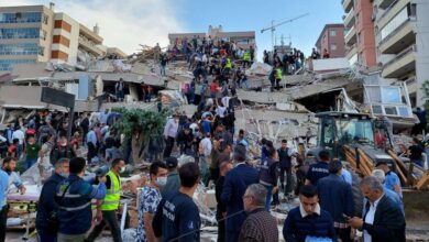

The most immediate human impact occurred in Germany, where a 40-year-old man was killed in the town of Georgenthal in the state of Thuringia on Thursday morning. According to reports from the newspaper Focus, the man was struck by a falling tree branch while walking his child to kindergarten; the child was unharmed. This incident underscores the immediate physical dangers posed by the storm fronts moving in from the southwest.
German meteorological services have issued warnings for the highest risk in 11 districts, including Eichstätt, Kelheim, and the cities of Ingolstadt, Augsburg, Ulm, and Memmingen. The German Weather Service predicts that storm fronts could deliver up to 30 litres of rain per square metre within an hour, accompanied by wind gusts reaching 80 km/h and hailstones up to two centimetres in diameter. Tornadoes had already swept through the states of Brandenburg and Hesse on Wednesday. In the Hessian town of Wetzlar, broadcaster Tagesschau reported that around 60 homes were damaged, with some losing their roofs entirely and debris scattered up to 100 metres away. Many of these buildings have since been declared uninhabitable.
The severe weather has extended into Austria, where Vienna was struck by heavy hail up to three centimetres in diameter. The first wave arrived around 2:30 pm, followed by a second at 4 pm, causing downpours that flooded streets and building basements. Traffic in the Austrian capital ground to a halt on many roads due to the chaos. The threat is now moving toward the Balearic Islands, with forecasters expecting powerful thunderstorms to hit Majorca on Thursday evening. These storms are predicted to bring wind gusts of up to 100 km/h and rainfall reaching 40 litres per square metre. Authorities in Palma have closed parks and the seafront promenade as a precaution. The same threat looms over Menorca, Ibiza, and Formentera.
Looking ahead, the most significant forecast concern lies in the Alpine regions. A storm warning is in effect for popular Alpine resorts, with northern Italy and Switzerland expected to be hit hardest. Forecast models indicate that the strongest storms will affect the regions of Piedmont, Lombardy, Liguria, and the area between Lombardy and Veneto. In the Alpine areas of northern Italy and southern Switzerland, rainfall of up to 200 litres per square metre could fall by the end of the week, significantly raising the risk of landslides, mudflows, and rockfalls.
In Austria, meteorological services are forecasting an exceptionally extreme amount of precipitation in southern Tirol. On Saturday alone, the region could receive up to 250 millimetres of rain, an amount that exceeds the average total for an entire summer in that area, according to NOS reports. Significant rainfall is also expected in Austria’s Vorarlberg province and northeastern Switzerland. The Austrian public broadcaster ORF reported that local mudslides and flooding are likely due to this extreme precipitation. Austria’s national weather institute has issued a yellow weather alert across large parts of the country, while Switzerland has implemented orange alerts in several regions due to anticipated heavy rain.
The Dutch motorists’ association ANWB has issued a warning to vacationers traveling to the Alps, noting that road conditions may become hazardous as a result of the severe weather and its consequences. In Italy, the weather platform Weerplaza reported that intense thunderstorms are expected in parts of Tuscany and around Lake Garda, potentially bringing strong wind gusts and large hailstones.
While Central and Southern Europe face rain and storm damage, the cold core of the deep trough is dragging cold weather over Scandinavia. As the trough moves, it combines with the frontal zone to produce substantial snowfall. Forecasts indicate that over the following seven days, the highest snow amounts will exceed 50 to 75 cm along central and northern Norway, as well as over Finland and northern Sweden. Meteorological services are closely monitoring the evolution of this zonal flow pattern and will update forecasts accordingly, urging the public to stay alert for potentially dangerous weather conditions along the rapidly moving frontal system.
This event follows a pattern of increasingly extreme summer weather in Central Europe. Last year, heavy rainfall caused widespread flooding across Romania, Poland, the Czech Republic, and Austria, killing at least 18 people. The current system highlights the continued volatility of the European climate, where rapid atmospheric shifts can produce life-threatening conditions across diverse geographic scales, from the Alpine valleys to the North Atlantic coast.