
The Promise of Floodplain Restoration
Floodplain restoration, a strategy that allows rivers to overflow into designated low-lying areas, has gained traction as a climate adaptation tool. The premise, rooted in hydrology, is that by providing rivers with room to spread, water flows more slowly, sinks into aquifers, and reduces the pressure on downstream levees. A century ago, after severe floods in 1907 and 1909, California began building bypasses like the Yolo Bypass, a “nature-based solution” that can carry roughly four times the Sacramento River’s flow. Today, the state is attempting to replicate this logic in the San Joaquin Valley, a region that historically lacked such infrastructure.
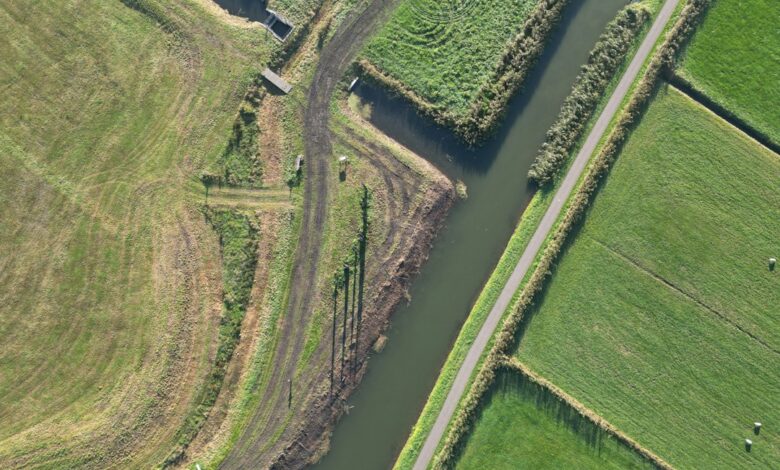
The centerpiece of this effort is Dos Rios State Park, which opened to the public in 2024 near Modesto. The 2,100-acre site, formerly two dairy farms struggling with soil salinity and routine flooding, was acquired by the nonprofit River Partners in 2012 and restored over 14 years. It represents the state’s largest public-private floodplain project. During the winter storms of 2023, the restored floodplain performed as designed. Julie Rentner, president of River Partners, noted that while it is difficult to isolate the project’s specific impact due to the complexity of the regional hydrology, the floodwater spread widely across the site. This inundation reduced downstream flooding impacts for up to four miles, preventing infrastructure damage and significant erosion. Rentner contrasts this with the 2017 high-water event, when the river was approximately a quarter-mile wide and nearly two feet deeper, exerting considerably more pressure on downstream levees.
Despite this success, advocates argue that current investments are insufficient for the scale of the threat. California has invested $40 million in San Joaquin Valley floodplain restoration since 2023 and set aside an additional $21.5 million for projects in Kern, Kings, and Tulare counties. However, Rentner estimates the state needs 50 more projects like Dos Rios to achieve meaningful risk reduction, potentially requiring 100,000 additional acres of restored floodplain. This expansion is complicated by what Rentner describes as “deep inertia” in state funding, which traditionally prioritizes the maintenance of existing concrete infrastructure over new nature-based capacity. For instance, while the state celebrated the completion of the nearly $31-million Tisdale Weir Rehabilitation in Sutter County, the San Joaquin Valley lacks comparable large-scale bypasses. The proposed Paradise Cut Bypass Expansion in Stockton has been mired in planning for a generation, leaving communities like Grayson and Hamilton City exposed.

The Stalled Insurance Pilot
Parallel to these physical infrastructure debates is a financial resilience experiment that has stalled. Two years ago, the small city of Isleton, a community of fewer than 800 people in a high-risk flood zone, launched a state-funded, community-based parametric flood insurance pilot. Parametric insurance differs from traditional coverage by paying out predetermined amounts triggered by specific metrics—such as water levels exceeding a certain height—rather than by the cost of assessed damage. This model allows for rapid payouts that can cover evacuation costs and lost revenue, bypassing lengthy claims processes.
The program was initiated by UC Davis graduate student Kathleen Schaefer, a former FEMA official, and was hailed by then-Insurance Commissioner Ricardo Lara as an innovative approach to helping vulnerable communities. The state funded the first year’s premium with $100,000. However, the pilot has since stalled. The special district created to administer the program, the Delta Region Geologic Hazard Abatement District, failed to retain enough board members to reach a quorum. This administrative collapse coincided with a broader governance crisis in Isleton, which prompted a Sacramento County grand jury investigation—the 10th in 35 years. Local officials and residents, including former council member Iva Walton, point to the town’s limited resources and the burnout of volunteer board members as primary obstacles.
The failure of the Isleton pilot does not negate the potential of parametric insurance, which is gaining traction elsewhere. The California Department of Insurance recently issued an opinion letter clarifying the regulatory framework for these products, and entities like the city of Santa Cruz and the Tahoe Donner homeowners association have since purchased such policies. Carolyn Kousky, executive director of Insurance for Good, notes that while the concept is sound, the practical challenges of sustaining premiums and distributing funds remain significant. In Isleton, roughly half of residential properties carry flood insurance, a rate higher than the state average but still below levels recommended by hazard mitigation experts. The community’s vulnerability is acute; in 1972, levee failures submerged the town under eight feet of water for months, a trauma that remains part of the local collective memory.

Policy Implications and Uncertainties
The convergence of a strong El Niño and these emerging strategies highlights a critical gap in California’s flood management. While the $10-billion climate bond approved by voters in 2024 provides a potential funding source, much of it remains unspent. The challenge for policymakers is not merely technical but structural. Expanding floodplain restoration requires a shift in funding priorities from maintaining legacy infrastructure to investing in new ecological capacity. Similarly, community-based insurance requires robust local governance structures that many small, under-resourced towns struggle to maintain.
As the winter storms approach, the immediate effects on infrastructure and communities will be the primary focus. Attribution science for specific flood events is complex; while climate change increases the likelihood and intensity of extreme precipitation, confirming a direct causal link to a specific levee failure or flood extent requires detailed post-event analysis. For now, the Dos Rios project offers a verified case study in how floodplain restoration can function as a “shock absorber,” but its scalability remains an open question. Meanwhile, the Isleton pilot serves as a cautionary tale for the administrative fragility of innovative financial tools in vulnerable communities. The next critical step for the state is determining whether it can mobilize the remaining climate bond funds to expand nature-based solutions and stabilize the financial frameworks necessary for long-term resilience.





One Comment