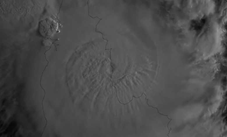
The cyclone’s path across three states marks the first instance of a tropical cyclone making a triple landfall on the Australian mainland in 21 years, a feat last achieved by Cyclone Ingrid in 2005. At its peak intensity over the Indian Ocean on March 26, Narelle reached maximum sustained winds of 130 mph (210 km/h), classified as a minimal Category 4 hurricane on the US Saffir-Simpson scale or a Category 5 on the Australian scale. While one source noted the system was a Category 5 with wind gusts up to 315 km/h prior to its first landfall, official tracking data indicates it made its initial Queensland landfall as a Category 4 with sustained winds of approximately 135 mph.
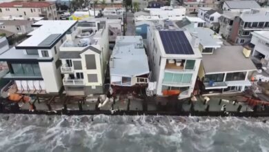
Damage in Queensland was described as relatively minimal by state officials, despite the storm’s intensity. Premier David Crisafulli reported downed trees, flooding, and power outages but noted that critical infrastructure remained largely intact. Rainfall in the Wenlock River region reached 200 mm. However, the impact was more severe in Western Australia, where more than 200 buildings in the town of Exmouth were reported damaged. Exmouth was cut off by floodwaters as the storm passed just offshore, with strong winds affecting the eastern side of the system.
The meteorological conditions that fueled Narelle’s rapid intensification included warm sea surface temperatures of 29°C (84°F) or higher and low wind shear in the Coral Sea and Gulf of Carpentaria. After weakening over land, the storm repeatedly re-energized upon re-emerging over warm waters. Upon entering the Indian Ocean, Narelle was steered southward by a subtropical ridge, allowing it to re-intensify significantly before hooking around the North West Cape. This track differs from typical Southern Hemisphere cyclone paths, which generally move southwest, but Narelle’s recurrence was driven by specific upper-level troughs and ridge configurations.
Following its final landfall, Narelle moved inland and weakened to a tropical depression. The Bureau of Meteorology has since issued warnings for a subsequent system, Severe Tropical Cyclone Maila, which is expected to target the same Cape York Peninsula region just three weeks after Narelle’s passage. Maila, currently a Category 3 system in the Solomon Sea, is forecast to potentially strengthen to Category 4 before hitting the coast, though its exact path remains uncertain. Meteorologists warn that Cape York could again face a direct hit, with sustained winds expected to reach 160 to 199 km/h if the storm maintains its projected trajectory.
Response and recovery operations are ongoing in the affected remote communities of Queensland, the Northern Territory, and Western Australia. The rarity of Narelle’s triple landfall highlights the complex atmospheric dynamics at play during the late spring cyclone season, while the imminent threat from Maila underscores the persistent risk to northern Australia’s coastal regions.