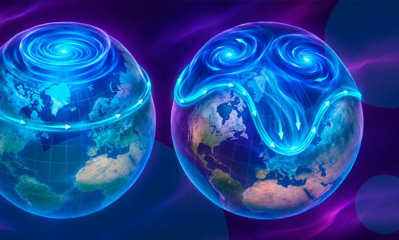
The Met Office and other forecast models indicate that this stratospheric change may influence the jet stream, increasing the likelihood of cold northerly or easterly winds reaching Britain. However, officials emphasize that a stratospheric disruption does not automatically produce widespread snow or prolonged freezing temperatures at the surface. The effects depend on how these high-altitude changes interact with lower-level weather patterns, a process that can take several weeks to manifest. If a major SSW develops, it could influence weather patterns for approximately 30 to 40 days, similar to the conditions preceding the “Beast from the East” in 2018, though current analysis suggests the impact may be less severe because air over Europe is not currently as cold as it was during that event.
Current models suggest that the coldest air may pool across Eastern Europe and Siberia, with Denmark, Norway, Sweden, and Germany identified as potential locations for the strongest regional effects. In North America, the interaction between the polar vortex and a strong El Niño pattern creates a dynamic weather outlook. The Climate Prediction Center favors above-average temperatures across much of the northern United States through November, as a stronger Pacific jet stream may repeatedly transport mild air, making it difficult for Arctic air to settle. Consequently, immediate U.S. cold is unlikely, with any potential influence from the vortex more probable in late November or December.

The phenomenon has drawn attention to broader environmental and energy concerns. A large-scale vortex collapse often leads to drier weather, a factor of concern given that the UK and much of Europe remain in a drought despite severe flooding in September attributed to El Niño. Additionally, Europe’s gas reserves stand at 72.4% at the start of winter, the lowest recorded level since 2011, raising energy security issues. Climatologist Judah Cohen of MIT described the event as “big” and “unprecedented” due to its early timing. While the specific mechanism linking El Niño to this particular vortex behavior is noted as a potential factor, the primary driver remains the stratospheric warming. Monitoring continues to determine if the vortex will fully split or reform, which will dictate the severity of the winter’s early months.